|
What did you learn? I learned that the farther the lines the longer the distance. What did you still have questions about? I still had questions about the types of lines on topographic map. |
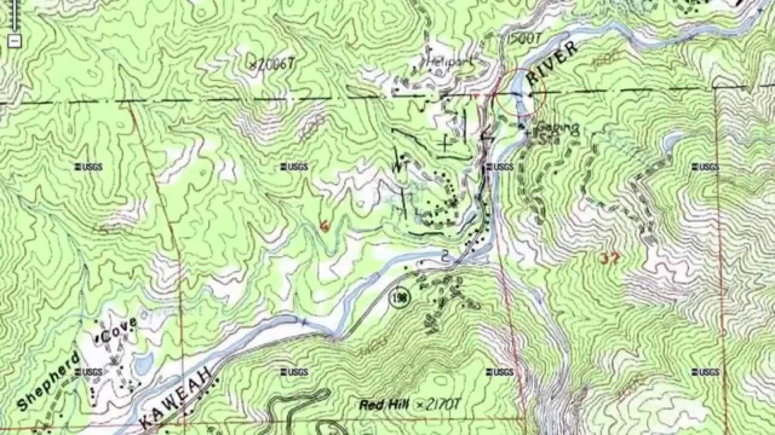
Topograpghic MapsTopographic maps are maps that give elevation of a certain area. On theses maps are contour lines that connect the areas with the same elevation. When the contour lines circle each other that means there is a hill or mountain there. In the center it will give you the highest elevation. Contour lines that are spread widely apart meanes that it is less steep and that its easier to climb. Contour lines that are tightly packed together or closer together means thatcthe elevation is steep and harder to hike or climb. If the contour lines make a upside down V shape that means a river runs throught there. The river is running in the direction thay the V opens up.
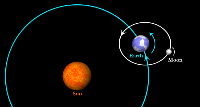
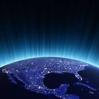
Earth Sun, and MoonThe sun is the center of our galaxy. Everything is revolving around it at different speeds. It is the closest star to us and is the right amount of distance away to give us the amount of sunlight and energy to survive. Everything that orbits the sun is held there by the suns gravitational pull. One thing that orbits the sun it the earth. The earth is where we live. It provides us with the essential things we need. Although by the wayy we are treating it, it might not for much longer. The earth rotates on its axis while revolving the sun. Revolving around the earth is the moon. The moon is the only thing that revoloves around us. The relationship between the sun, moon and the earth gives us the Lunar Cycle.
|

Plate Tectonic TheoryThe Plate Tectonic Theory was first thought of by Alfred Wegener. At first everyone thought he was insane. But when they could map the ocean floor more proof was discovered. They found out about the Mid-Atlantic ridge and seafloor spreading and saw the ground was moving. Then they learned more. Like subduction zones, whne one plate goes under another. Faults, when two plates are moving past each other, gronding against each other. Folded mountains, where two continental plates push into each other. Rift valleys, where they pull apart. Others too. So then they classified them as either continental or oceanic. Continental plates carry continents and oceanic plates carry oceans.

Lunar CycleThe Lunar Cycle occurs because of the positions of the earth, sun, and moon. The moon reflects the suns light as it revolves around the earth. As it revolves and the reflected sunlight changes the illuminated part. The illuminated part is called a phase. There are 8 major phases. The New moon, Waxing crescent, First quarter, Waxing gibbous, Full moon, Waning gibbous, Third quarter, Wanning crescent and finally back to New moon.
|
